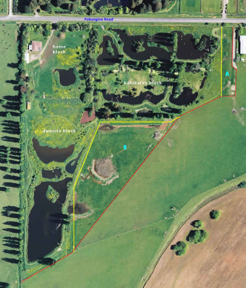
Adjacent land to the wetlands was purchased in mid 2010. Two parcels were acquired, "A" and "B". The yellow line in the image is the original fence boundary; the red line is the new boundary.
Parcel "A" extends the kahikatea block by 0.2 hectares (0.5 acres), protecting this area from incompatible development. A track through this area now provides easy access along the fence line to the lower reaches of the wetlands.
Parcel "B", now called the "Culling block", is 1.3 hectares (3.2 acres) and this acquisition is advantageous in several ways:
- The original wetlands was "L-shaped". The long-term activity in the critical pocket of the "L" was unknown. This block acts as a buffer zone for the kahikatea and damsite blocks.
- The farm drain along the lower side of the kahikatea block provided water to the wetlands, but this water supply was not secured as it was outside the wetlands boundary.
- The (original) lower fence line of the kahikatea block was outside the true surveyed boundary of the wetland. This was a convenience allowed by the owner at the initial stages of the project (2001). With acquisition of the Culling block, this no longer is an issue.
- Finally, this block will provide a different environment for wetland wildlife. The paddock is very wet and has an abundance of rushes growing. Surface water during the wet season is now able to flow over much of the paddock and this will create a swampy habitat. This water comes from overflow of the farm drain and from two artificial artesian springs (marked on the image by white Xs).